Texas Freeze: Nationwide Impacts and What to Expect.
Explore the far-reaching impacts of the Texas Freeze and learn what precautions and steps to take as this winter emergency unfolds. Stay informed and prepared.

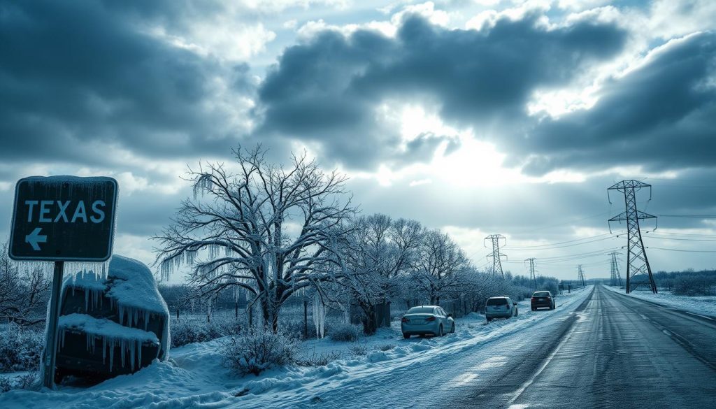
A big winter storm is hitting the US, bringing back memories of the Texas Freeze in 2021. Some Texans remember the fear and confusion from that time. Others worry about empty shelves and an “ice-pocalypse.” This time, forecasters think it won’t be as bad as before. More on this massive winter storm front.
An arctic front is moving into Texas, bringing cold air toward the Gulf Coast late Friday into early Saturday. This timing is important because moisture can stay after the front. A cold, wet layer near the ground can make rain turn into slick ice. The storm’s wide risk zone, from the South to the Northeast, is covered in winter storm warnings.
For Texas, the worry is not just freezing temperatures. It’s the mix of cold air, wind, and freezing rain. This mix can stress trees, power lines, and roads. It can quickly turn a cold snap into a Texas freeze emergency, even if outages are short and scattered. Get your home ready for winter freezing with this Home Winter Guide.
Extreme cold in Texas can affect more than just the state. It can impact travel, trucking, and energy demand. This can lead to changes in flight schedules, shipping times, and prices. Reports of cancellations and icing threats nationwide show this risk, including details from live winter storm updates.
There’s also a bigger picture. Climate patterns like La Niña can influence storms and cold shots later in winter. This keeps planners on alert even after this storm passes. A recent report on the La Niña winter outlook is available in the La Niña winter outlook report.
Texas Freeze Key Takeaways
- The Texas Freeze is high-stakes, but current signals do not point to a worst-case repeat of 2021.
- An arctic front is expected to drive Texas winter weather late Friday into early Saturday.
- Cold air combined with lingering moisture increases the risk of icing on roads, bridges, and overpasses.
- Localized outages are possible and could escalate into a Texas freeze emergency in some communities.
- Extreme cold in Texas can ripple into national travel and shipping through major hubs and corridors.
- Seasonal factors, including La Niña, may keep winter volatility in play beyond this event.
Texas Freeze forecast timeline and weekend weather setup
Forecasters are watching a fast-changing cold snap in Texas. It will hit in waves, with the worst part over the weekend. The weather setup is similar across the region, leading to winter storm alerts from the Hill Country to East Texas.
The cold and wet weather reminds people of Winter Storm Uri. Yet, current forecasts suggest it won’t be as bad as before. Travel and power outages are possible, though.
Two rounds of wintry weather are on the way. Small temperature changes can turn rain into ice. Texans are keeping an eye on Texas Storm Chasers for updates as the weekend approaches.
- Wave one: Tonight into Saturday morning, with freezing rain, sleet, and snow favored across the northern half of the state.
- Wave two: Saturday night into Sunday morning, when freezing rain and sleet may spread wider across Central, North, and East Texas.
Why this freeze is drawing Winter Storm Uri flashbacks, but worst-case outcomes are unlikely
The mix of cold air and moisture brings back memories of Winter Storm Uri. Roads can glaze quickly when it’s near 30°F. Ice can stick to almost anything below 28°F.
This setup differs from Winter Storm Uri in timing and where the worst icing will occur. A shorter window of heavy ice can limit how far impacts spread, even during a sharp cold snap.
Arctic front arrival window and where the coldest air is headed
An arctic front will surge into Texas late Friday into early Saturday. It will push the coldest air toward the Gulf Coast. National Weather Service meteorologist Cameron Batiste says the exact timing is uncertain, which can affect Friday temperatures.
As colder air deepens, areas north of Interstate 10 will trend below freezing by early Saturday. In the Panhandle and parts of West Texas, snow may stack up in inches. Where snow dominates and winds stay gusty, it can be even higher.
Extreme cold watch details for Southeast Texas, including timing and wind chill risk
The National Weather Service has posted an Extreme Cold Watch for much of Southeast Texas from Saturday night into Monday morning. Multiple nights of hard freeze conditions can follow, extending the cold snap beyond the last flakes or drops.
In and around the Houston area, wind chills could dip to near 0°F in the outer suburbs northwest of the city if northerly winds persist. Even where ice is limited, the cold can stress pipes, cars, and anyone caught outside too long.
Winter storm watch and the key question: when rain could change to freezing rain
A Winter Storm Watch covers Saturday and Sunday for parts of the region. The main question is when rain could turn to freezing rain. This is a big concern because roads and bridges will already be cold.
The best chance for accumulating ice is generally north of I-10, including parts of the Brazos Valley and the Piney Woods. If temperatures fail to climb above freezing on Sunday, slick travel and scattered power issues could linger into Monday morning. This keeps winter storm Texas impacts active even after precipitation tapers.
How the winter storm Texas cold snap could affect travel, supply chains, and the power grid beyond Texas
A snowstorm in Texas doesn’t stay in Texas for long. Cold air and messy precipitation can affect areas far beyond. This is true, as the demand for power and fuel peaks during winter.
Road and travel impacts: hazardous icing risk north of I-10 and how that can ripple through regional shipping routes
The biggest travel risks are north of I-10, where freezing rain is likely. The Brazos Valley and Piney Woods are at high risk, with bridges and overpasses icing first.
If it stays cold, roads could be hazardous from Saturday afternoon to Monday morning. This can slow down trucking, airport operations, and freight between Texas and nearby states.
Where ice accumulation is most likely and why it matters for trees, power lines, and localized outages
Forecasts show the highest ice accumulation risk north of I-10, in the Brazos Valley and Piney Woods. Even if Houston is spared, nearby areas could face problems with trees and power lines.
Northerly winds can keep temperatures low, slowing melting. This can turn small issues into big problems during a Texas ice storm.
Texas power grid failure concerns: what’s different from 2021 and what residents should watch for
People remember Winter Storm Uri and worry about power grid failures. This time, the risk is not as high as in 2021. But, there’s always a chance of problems.
They’ll watch for ice-related outages and high demand. Low temperatures and wind chills can make even short outages feel long.
Nationwide impacts: delays, logistics slowdowns, and price volatility tied to extreme cold in Texas
Grid stress isn’t just a Texas problem. PJM Interconnection and MISO have issued alerts. Federal agencies are closely watching reliability and prices.
Natural gas supply can suffer during extreme cold. Freeze-offs cut production, raising prices at hubs like Waha and Columbia Gas Appalachia. This can lead to pipeline constraints and volatile prices, as seen in Argus reporting on gas freeze-offs.
Businesses that rely on just-in-time deliveries face challenges. Slow trucks, adjusted warehouses, and higher fuel costs can lead to late deliveries and tighter margins. This can also raise concerns about the power grid if demand stays high.
Texas Freeze Conclusion
The Texas Freeze is coming, bringing sharp cold for several nights. It might also bring wintry rain, making roads slippery. But the forecast doesn’t predict the extreme weather seen in 2021.
The cold air will arrive late Friday into early Saturday. This will lead to extreme cold in Texas. An Extreme Cold Watch is issued for Southeast Texas from Saturday night to Monday morning. A Winter Storm Watch is also in effect for Saturday and Sunday.
The coldest nights could see temperatures in the teens and 20s. Wind chills will make it even colder for those outside. If roads freeze, travel could be disrupted, affecting more than just Texas.
Grid stress is a concern, but this freeze might not cause widespread power outages. Families and businesses should stay informed and plan for the coldest hours. For help with damage from the Texas Freeze, visit Texas Freeze Recovery Support.