Snowmaggedon Hits the US: Get the Latest Winter Storm Updates.
Stay ahead of the storm with live winter storm updates, severe weather alerts, and safety advisories across the US.
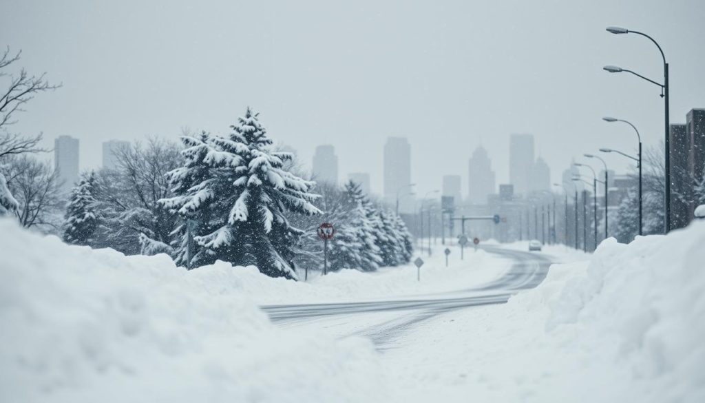
Winter Storm Updates: A massive winter storm is heading our way, bringing heavy snow, sleet, and freezing rain. It will affect a wide area of the United States. The storm could start on Friday and last through the weekend, with changes happening quickly from place to place. See Other Reports on this latest storm front hitting multiple States this weekend.
For the latest updates, many are watching severe weather alerts and hourly forecasts. AccuWeather warns that this storm could be very disruptive, affecting travel and daily life from the southern Plains to the Northeast. It might even be one of the biggest winter threats yet. How to get your home ready for this winter storm.
Some areas will see heavy snowfall, while others will face ice and sudden cold. To stay updated, follow AccuWeather’s storm forecast as it becomes clearer.
Over 230 million Americans could be affected, with slippery roads and canceled flights. Airports, like Richmond International Airport, are preparing for the storm. They are getting crews and special equipment ready for the weekend.
Local updates, like this one from 12 On Your Side, show the preparations underway.
NOAA forecasters also note the importance of La Niña. It influences where cold air and moisture meet, leading to quick changes in the weather. These details are covered in NOAA’s Climate Prediction Center coverage.
As the weekend approaches, staying flexible is key. This guide helps track severe weather alerts and storm movements. It also warns about travel disruptions and the cold that can follow the storm. Winter Storm Updates will be critical for making decisions about travel and daily activities.
Winter Storm Updates Key Takeaways
- Impacts may begin Friday and continue through the weekend in many regions.
- Heavy snow, sleet, and freezing rain could hit different areas in quick succession.
- More than 230 million Americans may be affected, making this a major national event.
- Severe weather alerts can change quickly as the storm track shifts.
- Travel disruptions may outlast the storm, especially if deep cold settles in afterward.
- Weather forecast updates may reflect La Niña-driven swings that reshape risk day to day.
Snowmaggedon Forecast: What Meteorologists Expect This Weekend
Meteorologists are watching a rapidly evolving setup that could bring a prolonged stretch of winter weather. For many readers, the key is steady snowstorm tracking as the system shifts east and pulls in colder air.
Instead of focusing on one number, they are urging people to follow weather forecast updates for timing and type. Small changes in the track can mean the difference between plowable snow and a glaze of ice.
Storm timeline: starting Friday and continuing through the weekend
The storm is expected to ramp up on Friday, then strengthen as it moves across the country through the weekend. Conditions may change by the hour as heavier bands set up and shift.
Overnight periods are often when travel gets hardest, so current snowfall reports can help people gauge how quickly roads are getting covered. They can also show where bursts of snow are outpacing treatment.
Expected hazards: heavy snow, sleet, freezing rain, and frigid temperatures
The main hazards include heavy snow, then pockets of sleet and freezing rain as warmer air tries to slide in aloft. That mix can create a thin, slick layer that is tough to see on sidewalks and bridges.
Behind the storm, colder air is expected to push in and hold, potentially keeping surfaces icy. Forecasters say weather updates should be watched closely for any switch from snow to sleet, as this can change the impact quickly.
- Heavy snow that reduces visibility and slows plowing
- Sleet and freezing rain that can coat roads and power lines
- Frigid air that can lock in ice and limit melting
How widespread it is: from New Mexico and Texas to parts of New England and the South
This is not a one-region storm. The footprint stretches from New Mexico and Texas into parts of the South, then up toward sections of New England as the system tracks east.
Regional outlets are already sharing localized guidance, including current snowfall reports and timing windows that can help people plan around the worst conditions.
Scale of impact: more than 230 million Americans potentially affected
With more than 230 million Americans potentially in the path of some impact, the weekend could bring ripple effects well beyond the hardest-hit zones. Supply runs, weekend events, and commutes may all be shaped by what falls and when.
Forecasters recommend keeping snowstorm tracking active through the weekend and using current snowfall reports to confirm what is actually reaching the ground. They also stress that weather forecast updates matter most right before travel, when precipitation type and temperature trends are clearer.
“Timing and precipitation type are the two details that can change the story for a neighborhood,” forecasters often note when a storm spans multiple climate zones.
Winter Storm Updates: Warnings, Advisories, and Areas Most at Risk
The storm is getting stronger from Friday to Monday. The alert map is filling up. Winter weather advisories warn of slow commutes and delayed errands.
Forecasters say conditions can change quickly. Snow, sleet, and freezing rain can switch fast. Weather emergency alerts are key when roads get icy and visibility drops.
National Weather Service alerts: advisories and warnings affecting more than 168 million people
The National Weather Service has issued many alerts. These include winter weather advisories and blizzard warnings in some areas. Over 168 million people are covered by these alerts.
Watches and warnings can change with each forecast. The temperature line is key. This is why storm coverage is so important.
Regions under threat: Arizona to New York and as far south as Texas
Alerts cover Arizona, the southern Plains, the mid-Atlantic, and the Northeast to New York. They also reach Texas in the south. Early impacts can start in Texas as Arctic air moves in.
The most at-risk areas are where snow and ice mix. Roads can quickly go from wet to icy. Weather emergency alerts may warn of service disruptions.
Major metro areas in the storm’s path: Dallas, Austin, Oklahoma City, Nashville, Atlanta, Charlotte, Washington, D.C.,
Big cities like Dallas, Austin, Oklahoma City, Nashville, Atlanta, Charlotte, Washington, D.C., Baltimore, Philadelphia, New York City, and Boston are near the storm. A slight shift in the storm’s path can determine whether it brings snow or rain. Winter weather advisories may turn into blizzard warnings in some areas.
What officials recommend: complete preparations ASAP and monitor forecasts for updates
- Complete preparations as soon as possible, if you need to travel or have medical needs.
- Closely monitor forecasts for updates, as changes in the storm’s path can affect alerts.
- Be ready for roads to get worse where snow and ice mix. Expect slower travel and possible outages.
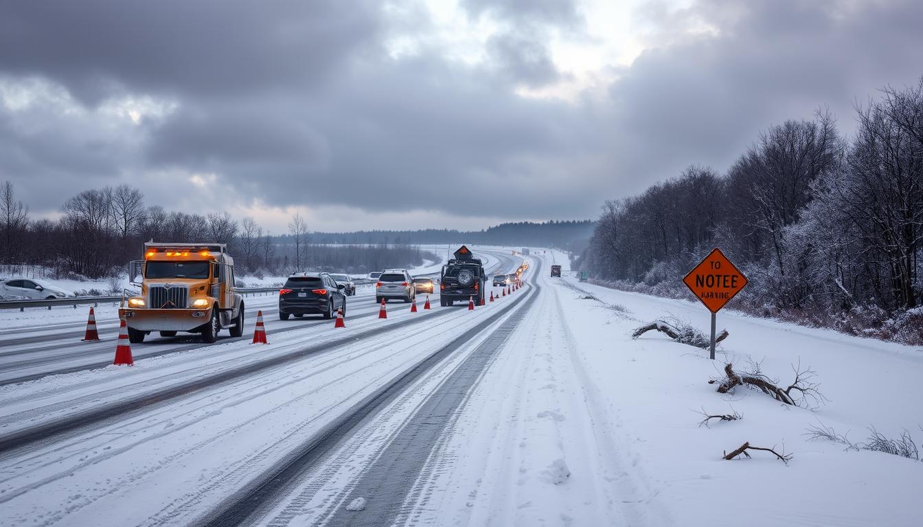
Travel Disruptions, Power Outages, and Frigid Temperatures After the Storm
Travelers and families are watching airports, highways, and the power grid closely. Snow, ice, and wind make severe weather alerts a big deal. They can turn simple trips into emergencies.
Flight impacts already underway
Flight delays are piling up. On Friday, over 400 flights were canceled, and more than 900 were delayed. This is all part of winter storm coverage.
Airports slow down when de-icing lines grow, and crews need breaks. This can affect many airports, even after the storm.
More cancellations ahead
Saturday looks tough for anyone trying to rebook. Over 1,470 flights were canceled, with more than 560 delayed.
Staffing issues can make things worse. This has happened during other disruptions, like shutdown-related travel impacts. Passengers face long lines, few counters, and limited gate options.
Road and community disruptions
The biggest worry is when slush turns to glaze. As temperatures drop, roads can become icy. This is a big problem on bridges, ramps, and untreated streets.
Communities may shut down travel and close schools as ice builds. Severe weather alerts will focus on timing. They’ll warn about when precipitation changes and when refreeze is likely to occur.
- Stagger travel to avoid the coldest hours when refreezing is most common.
- Keep a small car kit ready in case traffic stalls for long periods.
- Check local winter storm updates before heading out, not just the night before.
Power and heat risks
Ice is not just a driving hazard; it can also affect the power grid. When freezing rain coats branches and lines, they can break under the weight and wind. This leads to outages that take time to fix.
AccuWeather Chief Meteorologist Jonathan Porter warned that hundreds of thousands may lose power and heat for days. After the storm, the cold can linger. This keeps ice in place and slows repairs, even as severe weather alerts fade.
Winter Storm Updates Conclusion
Winter Storm Updates show a messy weekend ahead. The storm will move from New Mexico and Texas into the South and New England. It will bring heavy snow, sleet, freezing rain, and cold temperatures.
Small changes in temperature can quickly turn rain into ice. This means conditions can vary greatly from one place to another.
Over 230 million people could be affected. Winter weather advisories and warnings cover more than 168 million. In Georgia, Gov. Brian Kemp has declared a state of emergency.
He urges drivers to avoid North Georgia roads due to ice. For more details, check this state of emergency update. It’s best to stock up and stay indoors when roads become icy.
For tracking snowstorms, it’s key to check forecasts often. Travel plans may change quickly, with flights canceled or delayed. Road closures and school shutdowns are also possible.
Even after the storm, cold weather can cause problems. Ice can damage trees and power lines. Frozen pipes are also a risk when it’s cold.
Georgia Power is preparing to quickly restore power. You can find emergency resources through emergency downloads. After the storm, it may take time to get power, heat, and safe travel back.