Prepare for the Snow Cyclone This Weekend: What You Need to Know
Stay safe during the snow cyclone: Get tips on how to prepare and what to expect as extreme winter weather approaches this weekend.
Prepare for the Snow Cyclone This Weekend
Prepare for the Snow Cyclone: January is ending, and February is starting, which could bring a snowstorm to the East Coast. This weather event could catch even the most experienced drivers off guard. The storm’s impact can change quickly from one city to another.
Forecasters might call it a bomb cyclone, nor’easter, or blizzard. But the main message is clear: conditions can change fast. Preparing now can help avoid last-minute rushes, long lines, and dangerous travel.
Scott Homan, a senior meteorologist at AccuWeather, warned in a Jan. 29 email, “This storm could unleash heavy snow and howling winds across the Southeast this weekend.” This mix of heavy snow and strong winds can reduce visibility and strain power lines.
The cold air might reach farther south than usual. Even Florida could see snow flurries. Coastal areas farther north should watch for wind-driven water and rough surf.
This guide explains the forecast terms, where the storms might hit hardest, and what updates to watch. For a quick start, check out bomb cyclone basics and track alerts as they change.
It also shares safety tips, such as what to stock, when to stay off the roads, and how to plan for cold weather after snow and ice melt. The National Weather Service offers a checklist at weather.gov.
This system is part of a broader active pattern, so some areas may face additional hazards. For national coverage of wind and flooding risks, visit Network World News. For a report on the snow and ice, check their winter storm report.
Snow Cyclone Key Takeaways
- Snow cyclone impacts may vary widely by region, even within the same state.
- Whether it’s labeled a bomb cyclone, nor’easter, or blizzard, fast-changing conditions are the main risk.
- Heavy snow and high winds can arrive together, raising concerns for travel and power outages.
- Bitterly cold air could push far south, with a chance of flurries in Florida.
- Storm preparation should focus on heat, food, charging options, and a plan to limit driving.
- Safety tips and official alerts matter most as the storm deepens and its track shifts.
Snow cyclone forecast and why this weekend’s storm could be memorable
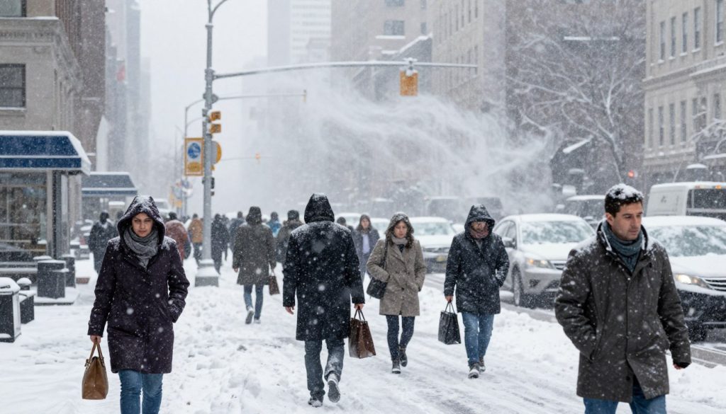
Forecasters are monitoring a winter storm that could change quickly. Over Friday and Saturday, a blizzard threat could develop within hours. This fast change is why officials might quickly move from routine advisories to a snow emergency.
Early weather updates show snow spreading from the southern Appalachians on Friday night. It will then move up the coast as winds get stronger. The cold air behind the storm will also keep roads icy and refreeze slush after plows pass.
Bomb cyclone, nor’easter, or blizzard: what forecasters are calling it
Forecasters are using different terms for the same storm. “Bomb cyclone” refers to the storm’s rapid strengthening. “Nor’easter” focuses on the coastal track and strong northeast winds. “Blizzard” is about the impacts, like wind-driven snow and low visibility.
For timing and coastal flooding, here are some storm timing details.
What meteorologists are warning about is heavy snow and howling winds
AccuWeather is warning about the dangers of heavy snow and strong winds. Senior Meteorologist Scott Homan said there’s a risk of “dangerous blizzard conditions” in some coastal areas. These winds can also cause tree limbs to snap, resulting in scattered outages.
Blizzard conditions and treacherous travel risks along the East Coast
AccuWeather is concerned about blizzard conditions from North Carolina to the southern Jersey shore. The National Weather Service warns of “sharply reduced visibilities” that will make travel “extremely treacherous” in some areas.
Drivers face danger when powder is blown back onto cleared lanes. Even short trips can become risky in a blizzard. Delays can affect transit, airports, and local supply runs.
Weather updates to watch: rapidly deepening storm and onshore winds
The focus is on a rapidly deepening storm and strong onshore winds, near high tide. This can raise water levels along exposed shorelines. Snow bands pivoting inland can also cause brief whiteouts.
- Shifts in the storm track that move the heaviest snow band closer to the coast
- Wind gusts that turn steady snowfall into blowing snow and near-zero visibility
- Any snow emergency announcements tied to bridges, coastal roads, and reduced plow access
- Fresh weather updates as cold air locks in and precipitation types change
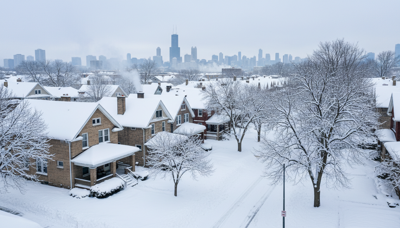
Cold air pushing deep into the South can complicate travel and shipping beyond the East Coast. Energy and logistics concerns associated with the broader freeze pattern are outlined in this Texas freeze report.
Where the winter storms may hit hardest: snowfall, wind, and coastal flooding outlook
Forecasters are focusing on where winter storms will dump the most snow. They also warn of strong winds and coastal flooding. In many areas, the biggest risks are ice, heavy snow, and extreme cold.

These dangers can change quickly, depending on the storm’s path. For the latest updates, many are monitoring storm forecasts and coastal impacts as the system strengthens.
Carolinas and Virginia Tidewater: major snowstorm and local totals
North Carolina and the Virginia Tidewater could see a major snowstorm. Over 6 inches of snow is likely, according to Weather.com. AccuWeather’s Alex Sosnowski says Charlotte, Raleigh, and Greensboro could see their biggest snowstorm in decades.
In Virginia, Sosnowski predicts Norfolk could see more than 11 inches of snow. Forecast totals for key cities include 8.4 inches in Raleigh, 7 inches in Greensboro, and 6 inches in Charlotte. This could make simple tasks take all day.
Southeast impacts beyond the Carolinas: eastern Georgia, eastern Tennessee, and southern West Virginia
The National Weather Service says snow is likely in eastern Georgia, eastern Tennessee, and southern West Virginia. Even a little snow in hilly areas can make roads slippery.
Strong winds and heavy snow on trees could cause power outages. Travel could become dangerous or even impossible. There’s a risk of widespread closures and disruptions.
Florida: flurries possible, but the bigger story is bitterly cold air statewide
Florida might see some flurries, but the real story is the cold air. The Tampa-area National Weather Service predicts light snow/rain showers or snow showers/flurries on Saturday, Jan. 31.
The bigger issue is the frigid temperatures statewide. Wind chills make outdoor work difficult and raise safety concerns. Extreme weather means focusing on pipes, pets, and morning commutes on slick bridges.
Mid-Atlantic coast: Delaware, New Jersey, and Maryland snow amounts plus near hurricane-force wind gusts
Along the Mid-Atlantic coast, snow amounts might seem small. But wind and water could be the main threats. Sunday, Feb 1st, could see strong winds and coastal flooding.
The National Weather Service warns of powerful winds and coastal flooding. Coastal flooding could become a significant problem during nor’easters. This is detailed in. This is detailed in Severe Weather Europe’s bomb cyclone coverage.
Forecasters advise monitoring the rain-snow line and timing updates. A small shift can change the risk from snow to wind. More on this is in the latest weekend storm breakdown, important for drivers and coastal communities.
Snow Cyclone Conclusion
Whether it’s called a bomb cyclone, nor’easter, or blizzard, this snowstorm is significant. It’s like a standout storm in late January or early February along the East Coast. The key is to start getting ready for the storm before it hits, not after.
Weather updates are also key. They help people adjust their plans as the storm evolves.
The main dangers are heavy snow, strong winds, and the chance of blizzard conditions. This can make driving very dangerous. For example, this winter storm coverage shows how snow, ice, and cold can affect travel and power systems.
In North Carolina and Virginia, the snow totals and timing are not yet certain. But the threat is real. The areas around Raleigh, Greensboro, and Charlotte are at risk. Strong winds can cause power outages, further complicating the situation.
Coastal areas should also watch out for flooding. This is due to strong winds, near hurricane-force gusts, and high tides. These storm details are important to know.
The storm’s impact may seem unusual in the South, with possible snow in Florida and cold air across the state. Safety tips are essential when temperatures drop. Keeping warm, having backup heat, and staying informed are key. This is similar to being prepared for rapidly changing weather, such as updates on Tropical Storm Alvin.