Tropical Storm Priscilla Tracking Along Mexico’s Pacific
Stay updated on Tropical Storm Priscilla tracking along Mexico’s Pacific coast with the latest path details and weather forecasts.
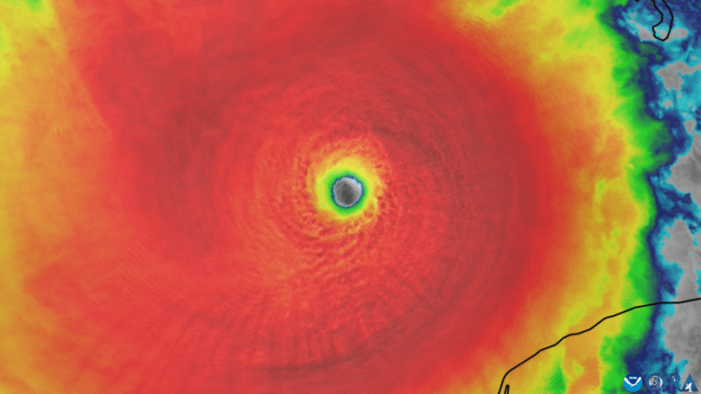
Tropical Storm Priscilla tracking along Mexico’s Pacific leads today’s Priscilla storm news. The system is moving northwest off Mexico’s west coast. The U.S. National Hurricane Center in Miami reports that Priscilla weakened to Category 1.
Early Wednesday, Priscilla’s sustained winds were near 75 mph. The storm moved at 7 mph. It was about 195 miles west-southwest of Baja California’s southern tip.
Large swells were heading toward coastal resorts and fishing towns. A tropical storm watch was issued from Cabo San Lucas to Cabo San Lázaro. Forecasters warned of heavy rain and flash flooding along the Pacific shore.
Residents and travelers are keeping an eye on the Priscilla tracker map. Seas are building across southwestern and west-central Mexico, as well as the southern Baja California Peninsula. The National Hurricane Center warns of dangerous surf and rip currents, as well as torrential downpours.
For a deeper briefing on wind strength and surf hazards, see this latest report. It tracks how the system neared major status before easing. This developing picture will continue to be updated as Priscilla rides along the coastline.
Tropical Storm Priscilla Tracking Along Mexico’s Pacific: Key Takeaways
- Priscilla weakened to Category 1 with sustained winds near 75 mph.
- The center is about 195 miles west-southwest of Baja’s southern tip.
- Movement is to the northwest at roughly 7 mph.
- Tropical storm watches are posted from Cabo San Lucas to Cabo San Lázaro.
- Large waves, dangerous rip currents, and heavy rain pose a flash-flood risk.
- Travelers should monitor the priscilla tracker map for near-term changes.
Current Conditions and Storm Status
The Priscilla weather forecast shows a small but dangerous storm over open water. The National Hurricane Center reports a weakening trend. However, marine hazards are particularly high in coastal areas. For more details on the storm’s track and timing, see this pacific storm priscilla update. It covers surf and rainfall threats tied to Hurricane Priscilla, Mexico.
Hurricane Priscilla Weakens to Category 1 with 75 mph Winds
Priscilla is now a Category 1 hurricane with winds near 75 mph. Forecasters predict it will weaken further over the next two days. Outer rain bands could lead to flooding in some areas.
Storm Motion and Location: Northwest at 7 mph, 195 Miles WSW of Baja’s Southern Tip
The storm is 195 miles west-southwest of Baja California’s southern tip. It’s moving northwest at 7 mph. This keeps the storm’s core offshore, but swells will hit the peninsula.
Large Waves Impacting Southwestern and West-Central Mexico and Southern Baja
Large waves and strong rip currents are hitting beaches from Jalisco to Baja California Sur. Small craft should expect rough seas and hazardous surf. A recent hurricane, Priscilla, in Mexico, has prompted a report warning of beach erosion and dangerous shore break.
Advisories in Effect: Tropical Storm Watches for Baja California Sur
A tropical storm watch is in effect from Cabo San Lucas to Cabo San Lázaro. Gusty winds, heavy rain, and sudden flash flooding are possible. Travelers and boaters should track every Pacific storm update and follow local guidance as conditions change.
Note: Coastal impacts may vary block by block based on orientation and local bathymetry; stay tuned to official advisories for the latest Priscilla weather forecast.
Tropical Storm Priscilla Tracking Along Mexico’s Pacific
Tropical cyclone Priscilla is moving northwest along the Pacific. It’s keeping its center just offshore, causing rough seas and changing skies. It’s about 195 miles west-southwest of Baja’s southern tip, in an active watch area.
For a quick update on winds, motion, distance, and surf, check this Pacific storm Priscilla update.
Storm Priscilla Path and Priscilla Tracker Map: West Coast Mexico Trajectory
The storm is following the west coast of Mexico, moving northwest. The strongest winds are over open water. Mariners approaching the entrance to the Gulf of California should be aware of changing weather conditions.
This path also indicates the storm’s location in relation to shipping lanes and beaches. Local ports can expect reduced visibility, gusty winds, and high swells.
Rainfall and Flash-Flooding Risks Along the Pacific Coast and the Southwestern U.S.
Heavy rain and fast flooding are possible from Jalisco to southern Baja. Areas with poor drainage and steep canyons are at high risk.
In Arizona and New Mexico, leftover moisture may cause urban flooding. Travelers should avoid low-water crossings during rain.
Pacific Storm Priscilla Update: Expected Gradual Weakening Through Wednesday
The storm is expected to weaken gradually over the next few days, reaching its peak on Wednesday. This is as it moves away from the mainland. Large waves will continue to pose dangers.
Beachgoers should watch for flags and lifeguard advice. Offshore rigs and charter fleets should secure gear and stagger departures.
Mexico Storm Priscilla Location: Impacts Near Cabo San Lucas to Cabo San Lázaro
The storm is affecting the area from Cabo San Lucas to Cabo San Lázaro. This area is under a watch, with squally episodes and high surf. Coastal flooding is possible at high tide.
As bands wrap in, brief gusts of 35–45 mph may hit exposed points. For a broader U.S. weather view, see this storm outlook.
Related Tropical Activity and Regional Forecasts
Forecasters are closely monitoring the Pacific and Atlantic basins. They see changes in storm risks this week. As we follow Priscilla Storm’s news, we also look at a system in the Caribbean.
The official forecast discussion indicates changes in storm paths and strength. This helps communities and shipping routes prepare.
Tropical Storm Jerry Strengthening Toward the Leeward Islands
Tropical Storm Jerry has winds of about 60 mph. It’s 750 miles east-southeast of the northern Leeward Islands. It’s moving fast, near 23 mph, and could hit the islands late Thursday or Friday.
People from Guadeloupe to Anguilla should watch for updates. Even as we track storms in the Pacific, Jerry’s path is essential for travel plans.
Jerry’s Forecast: 60 mph Winds, Could Be a Hurricane by Weekend
The National Hurricane Center expects Jerry to get stronger. It might become a hurricane by the weekend. Sea heights and squalls may increase, affecting areas around the storm.
Those tracking storms in the Pacific should also keep an eye on Jerry. A slight change in its path could bring strong winds to some areas.
Leeward Islands Impacts: 2–4 Inches of Rain and Flash Flood Risk
Heavy rain bands could bring 2 to 4 inches of rain to the northern Leeward Islands. Quick flooding is possible in urban areas and on steep slopes.
Clear storm drains and avoid low-water crossings. Keep an eye on the Priscilla weather forecast. Remember, other storms can also affect the area.
Watches in Effect: Antigua, Barbuda, Anguilla, and Neighboring Islands
Tropical storm watches are in effect for Antigua, Barbuda, and Anguilla. Also, St. Kitts, Nevis, and Montserrat; St. Barts and St. Martin; Saba and St. Eustatius; and Guadeloupe and nearby islands. Ferries and ports might change their plans as the weather does.
In the eastern Pacific, Tropical Storm Octave is weakening and poses no threat to land. For more on severe weather in the Atlantic, see this overview. Stay updated on Priscilla Storm news for readiness in both basins.
Tropical Storm Priscilla Tracking Along Mexico’s Pacific Conclusion
Priscilla is the primary focus for tracking along Mexico’s Pacific. The National Hurricane Center says it’s now a Category 1 storm. It has 75 mph winds and is moving northwest at 7 mph, about 195 miles from the Baja California Sur tip.
Large waves and rough seas are hitting southwestern and west-central Mexico. The southern Baja Peninsula is also affected. A tropical storm watch is in place from Cabo San Lucas to Cabo San Lázaro.
Heavy rain and flash flooding are possible along the Pacific coast. The forecast indicates that moisture could reach parts of the southwestern United States later this week. For more on marine hazards and rainfall, see this tropical weather update. Residents should secure loose items and stay out of surf zones.
In the Atlantic, Tropical Storm Jerry has 60 mph winds and might become a hurricane near the northern Leeward Islands. It could bring 2–4 inches of rain, leading to flash flooding. Farther west, Tropical Storm Octave is weakening and won’t pose a threat to land.
Health risks are a concern after storms and heavy rain. Storms can lead to more emergency visits and worsen chronic conditions. This is true for older adults and infants. For tips on health impacts and stress management, check this public health brief. Stay updated with NHC advisories and local officials for the latest on Priscilla.
Tropical Storm Priscilla Tracking Along Mexico’s Pacific FAQ
What is the current status of Hurricane Priscilla in the eastern Pacific?
Priscilla has weakened to a Category 1 hurricane. It has maximum sustained winds around 75 mph (120 kph). It is moving northwest and staying offshore, but it continues to influence coastal weather along Mexico’s Pacific side.
Where is Priscilla located, and how fast is it moving?
The center is about 195 miles (315 kilometers) west-southwest of the southern tip of Baja California. It is moving northwest at 7 mph (11 kph), keeping its core offshore but close enough to affect coastal conditions.
What hazards are affecting Mexico’s west coast and southern Baja right now?
Large, long-period swells are producing dangerous surf and rip currents along southwestern and west-central Mexico and the southern Baja California peninsula. These conditions pose risks for beachgoers and small craft.
Are there advisories in effect for Baja California Sur?
Yes. A tropical storm watch is in effect from Cabo San Lucas to Cabo San Lázaro due to Priscilla’s proximity and the risk of strong winds, high surf, and heavy rain.
How does the storm Priscilla’s path look on the Priscilla tracker map?
Forecast guidance from the National Hurricane Center shows a northwest track along Mexico’s Pacific, with the center remaining offshore. The Priscilla tracker map highlights the closest impacts near the corridor from Cabo San Lucas to Cabo San Lázaro.
What is Tropical Storm Priscilla tracking along Mexico’s Pacific timeline for weakening?
The Pacific storm Priscilla update indicates gradual weakening through Wednesday as the system moves farther from mainland Mexico. Even with weakening, coastal impacts will persist for a time due to lingering swells and moisture.
Will Priscilla bring heavy rainfall or flash flooding?
Yes. Forecasters warn of heavy rainfall and flash flooding along sections of Mexico’s Pacific coast. Moisture from Priscilla’s circulation could also reach the Southwestern United States later this week into the weekend.
What areas in Mexico are most likely to see direct impacts?
The Mexico storm Priscilla location places the most likely impacts near Baja California Sur from Cabo San Lucas to Cabo San Lázaro, where watches are posted. Coastal zones along southwestern and west-central Mexico may experience large waves and hazardous marine conditions.
Is there a Priscilla weather forecast for surfers and mariners?
The Priscilla weather forecast calls for large swells, rough seas, and strong rip currents along the west coast of Mexico and southern Baja. Small craft should exercise caution and monitor official marine advisories.
How does Tropical Cyclone Priscilla in Mexico compare to prior days?
Priscilla approached major hurricane strength on Tuesday but fell back to Category 1 by Wednesday morning. Winds are near 75 mph (120 kph), with continued gradual weakening expected.
What’s the latest on Tropical Storm Jerry in the Atlantic?
Jerry has top winds of 60 mph (95 kph) and is moving west-northwest at 23 mph (37 kph) about 750 miles (1,210 kilometers) east-southeast of the northern Leeward Islands. Gradual strengthening is expected, and it could reach hurricane status by the weekend.
Which islands have watches for Jerry, and what impacts are expected?
Tropical storm watches are in effect for Antigua, Barbuda, Anguilla, St. Kitts, Nevis, Montserrat, St. Barts, St. Martin, Saba, St. Eustatius, and Guadeloupe and nearby islands. Expected rainfall is 2 to 4 inches (5 to 10 centimeters), with a risk of flash flooding.
When could Jerry affect the northern Leeward Islands?
The core of Jerry is forecast to pass near or north of the northern Leeward Islands late Thursday into Friday. Residents should monitor NHC advisories and local guidance.
What’s happening with Tropical Storm Octave in the Pacific?
Octave is weakening with 40 mph (65 kph) winds, located about 660 miles (1,065 kilometers) southwest of the southern tip of Baja California. It is expected to dissipate by Thursday night and poses no threat to land.
Where can people find a reliable Priscilla tracker map and updates?
The U.S. National Hurricane Center provides an official priscilla tracker map, cone graphics, and advisories. Local meteorological agencies in Mexico and reputable outlets frequently post updates on Pacific Storm Priscilla.