Massive Winter Storm to Hit the South This Weekend.
Prepare for a major Winter Storm sweeping the South this weekend—stay informed on blizzard warnings and safety precautions.

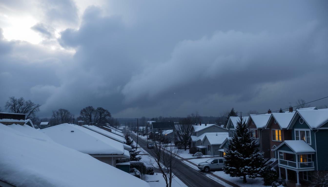
Winter Storm Warning
A massive Winter Storm is coming to the United States this weekend, starting on Friday. It will bring snow, sleet, and freezing rain from Central Texas to the Northeast. The cold air will follow, making things even worse.
More than 180 million Americans will be affected by this storm. It could be one of the most significant storms of the winter. The worst areas will be where ice and wind meet.
The storm is not just about snow. It’s about how it affects roads and power lines. The National Weather Service warns of dangerous travel conditions, tree damage, and prolonged power outages in the Southeast. The cold will stay long after the snow stops. For more details, check out this winter storm report.
This storm fits into a bigger winter pattern. La Niña is making storms aim for specific places and bringing cold snaps, says a La Niña winter outlook.
There’s also extra moisture from the West. Remnants from the Pacific could bring rain and snow in the Southwest. This adds to the storm’s complexity. For more on this, see this Priscilla tracking update.
Next, we’ll look at the storm’s day-by-day forecast. We’ll see where it hits hardest and how maps show snow and ice zones. We’ll also share tips for staying safe during the storm, including travel advice and guidance on preparing for power outages.
Winter Storm Warning Key Takeaways
- The Winter Storm is forecast to begin Friday and last through the weekend, from Texas to Massachusetts.
- Heavy snow, sleet, and freezing rain could create dangerous travel and widespread delays.
- The snowstorm forecast highlights the most significant risk where ice and wind combine, raising outage concerns.
- Very cold air behind the winter storm may extend hazards after precipitation ends.
- Winter weather precautions include avoiding unnecessary travel and preparing for possible power loss.
- Forecast-map breakdowns ahead will separate likely snow bands from freezing rain and ice totals.
Storm overview: massive system stretching from Texas to Massachusetts
A huge winter storm is moving from Texas to Massachusetts. It will affect the South, the Plains, the Appalachians, the mid-Atlantic, and the Northeast. Even small changes in its path can greatly impact where it brings heavy snow or ice. The latest Winter Storm Fern forecast is showing these changes.
The storm will bring snow, sleet, and freezing rain in different areas. Travel will be tricky, as conditions can change quickly near the freezing line. A severe weather advisory might be issued where winds are strong and visibility is low.
Official alerts are already building. Winter storm watches cover 70 million people from New Mexico to North Carolina. This includes Texas. The National Weather Service advises people to prepare for a long and impactful storm.
- Expect a shifting mix of snow, sleet, and freezing rain along the storm’s main track.
- Plan for slick bridges and untreated roads, especially overnight and early morning.
- Watch for updates as the approaching cold front can tighten the ice zone and extend its impacts.
After the storm passes, very cold air will follow. This can keep roads slippery. So, the storm’s effects can last even after the snow stops. AccuWeather’s outlook provides more details. Officials keep reminding everyone to stay prepared.
Winter Storm forecast maps: snow accumulation, ice totals, and blizzard warning risk
Forecast maps are becoming clearer on the snowstorm. They show where the snow will fall heaviest and where travel might slow down. Even without a blizzard warning, wind and heavy snow can cut visibility.
In the South, the main concern is not just deep snow. It’s the mix line where rain turns to sleet and freezing rain. Alabama might see 2 to 3 inches of snow and sleet in a narrow area, with higher totals in some spots. Many central areas will see sleet, freezing rain, or cold rain, as shown in Alabama ice timing updates.
Snow accumulation forecast by region
The National Weather Service says the Southern Rockies and south-central Plains will see mostly snow. The Central Plains could get 6 to 12 inches. The Appalachians might see over 2 feet of snow if the storm stays put for hours.
Further northeast, the forecast is less certain. But significant snow is possible. The maps also warn of snow-covered roads, low visibility, and travel disruptions.
Ice accumulation and freezing rain zones
Ice totals are often overlooked but can cause the most problems. Some areas could see ice accumulation of 0.25 inches or more. This ice can make bridges, trees, and power lines slippery.
- Freezing rain zones often sit just south of the heavier snow swath.
- Sleet bands can create a rough, crunchy layer that slides under tires.
- Small track shifts can move the worst ice totals county by county.
Severe weather advisory and cold front approaching impacts
As the cold front approaches, some areas may see severe weather. This can include thunderstorms on the warm side and freezing conditions on the cold side. The timing window for these changes is about 24 to 36 hours, starting around midnight Friday.
Many people use checklists to prepare for snowstorms. They include backup charging options and clear travel plans. For organizing, free PDF downloads can help keep important information in one place. Even without a blizzard warning, ice and snow can make driving slow and stressful.
Impacts to major metros: icy roads, travel shutdowns, school closures, and power outages
Forecasters predict widespread disruption as the storm heads toward major cities. Places like Dallas, Austin, and Nashville will see significant impacts. Sleet can quickly turn to snow, and treated roads can freeze over.
For the latest updates, many follow storm coverage as conditions change.
Driving becomes risky when icy roads form from freezing rain. Colder air can make these roads even more dangerous. Winter weather precautions are essential to stay safe.
- Travel may pause in bursts as visibility drops and snow bands thicken.
- Local agencies may close ramps or steep routes when traction is poor.
- Drivers who must go out can rely on winter storm safety tips like slowing down early, leaving extra space, and keeping a charged phone.
Schools may close across multiple states due to icy conditions. Plows and salt struggle against hard ice. Families should plan childcare and meals before roads get slick.
Aviation is also affected. Over 4,000 flights may be canceled this weekend. Travelers should pack essential meds and watch gate changes closely. Some save offline documents from free PDF downloads before Wi‑Fi gets crowded.
Power outages are a major concern. AccuWeather Chief Meteorologist Jonathan Porter warns that hundreds of thousands may lose electricity and heat for days. Icy roads and sidewalks will stay hazardous, slowing recovery.
Winter Storm Warning Conclusion
This Winter Storm is expected to be very wide and impactful. It will bring heavy snow, sleet, and freezing rain from Texas to Massachusetts. It’s forecasted to affect around 180 million people.
Even if snow totals are not high, ice and wind can make travel very dangerous. This is true even for short trips.
The National Weather Service has already issued winter storm watches for 70 million people. Some areas might see a blizzard warning if the storm gets worse. Drivers and public transit users should get ready for slow travel, closures, and long waits.
Utilities and local agencies are preparing for power outages and service disruptions. This is because of the storm.
After the main storm passes, the cold air might refreeze any water left. This could make sidewalks, bridges, and back roads slippery again. It might also slow down cleanup efforts.
The key advice is to stay up to date with the National Weather Service. Start preparing early. Use winter storm watch preparation tips to get ready. If you must travel, keep an eye on alerts because the storm can change quickly.